Skip to Main Content
|
|
|
Toggle navigation
Ask a Librarian
View Hours
Support the Library
My Accounts
Search
Catalogs
Library Catalog
UBorrow
BorrowDirect
WorldCat
Other Catalogs
Other Search Tools
Articles Plus
Database Finder
EJournals
Website Search
Borrow
& Request
Borrowing
Borrowing & Renewing
Due Dates & Loan Periods
Fines & Lost Items
Course Reserves
My Accounts
Requesting
Request Articles & Chapters
Request Books & Other Media
Suggest a Purchase
Research
& Teaching
Research Help & Tools
Ask a Librarian
Subject Specialists
Citation Management
Help Guides
Subject Guides
Teaching Support
Course Reserves
Research Instruction for Courses
Scholarly Communication & Publishing
Dissertation Office
Digital Scholarship
Copyright Info
Collections
& Exhibits
Collections
Notable Collections
Digital Collections
Collecting Areas by Subject
Other Local Collections
Exhibits
All Exhibits
Web Exhibits
Research Centers
East Asian Collection
Maps Collection
Southern Asia Collection
Special Collections
Spaces
& Services
Using Our Spaces
Visiting the Library
Library Hours
Book a Room
Places to Study
Copy, Print, Scan
TECHB@R
Libraries
Our Locations
Crerar
D'Angelo Law
Eckhart
Mansueto
Regenstein
Special Collections
SSA
About
About the Library
Mission & Strategic Plan
Facts
Departments & Staff
Employment
Support the Library
Library Surveys & Reports
Library Policies
Conferences
Library Boards & Committees
News & Events
News
Workshops & Events
Libra (newsletter)
Social Media Directory
Collections & Exhibits
>
Collections
>
Mapping Chicagoland
> Results with subjects: Street-railroads
Results with subjects: Street-railroads
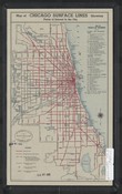
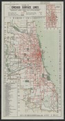
Map of Chicago surface lines.
Local ID(s):
maps-0239
Language(s):
English
Spatial(s):
7013596
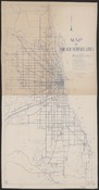
Rapid transit and streetcar lines which serve Chicago.
Local ID(s):
maps-0234
Language(s):
English
Spatial(s):
7013596
Rice's Pathfinder map of automobile roads--forest preserves--golf courses--interurban railways--lakes and steam roads within fifty miles of Chicago /
Local ID(s):
maps-0193
Language(s):
English
Spatial(s):
Illinois -- Chicago Metropolitan Area
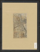
Map of Chicago surface lines showing points of interest in the city /
Local ID(s):
maps-0245
Language(s):
English
Spatial(s):
7013596
Map of Chicago surface lines and Chicago rapid transit system showing stations at which transfers can be made.
Local ID(s):
maps-0242
Language(s):
English
Spatial(s):
7013596
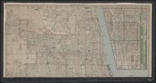
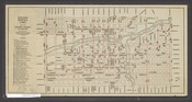
Rand McNally pocket map of Chicago business district.
Local ID(s):
maps-0072
Language(s):
English
Spatial(s):
7013596
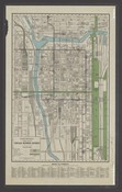
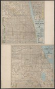
New street number guide map of Chicago.
Local ID(s):
maps-0289
Language(s):
English
Spatial(s):
7013596
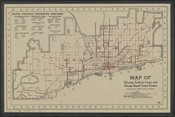
System of Chicago surface lines :showing principal points of interest and direct lines of transportation : surface lines take you everywhere.
Local ID(s):
maps-0237
Language(s):
English
Spatial(s):
7013596
Skeleton map of Chicago showing locations of steam and elevated railroad stations and surface car lines.
Local ID(s):
maps-0232
Language(s):
English
Spatial(s):
7013596
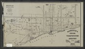
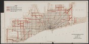
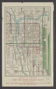
Chicago Surface Lines routes in central business district.
Local ID(s):
maps-0075
Language(s):
English
Spatial(s):
7013596 7015700
New street number guide map of Chicago.
Local ID(s):
maps-0293
Language(s):
English
Spatial(s):
7013596
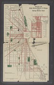
Municipal railway system, City of Chicago.
Local ID(s):
maps-0233
Language(s):
English
Spatial(s):
7013596
Vacation and sight seeing district of Chicago, served by Chicago Surface Lines.
Local ID(s):
maps-0137
Language(s):
English
Spatial(s):
7013596
Rand McNally pocket map of Chicago business district.
Local ID(s):
maps-0071
Language(s):
English
Spatial(s):
7013596
Search & Browse
Browse Collection by
Subject
Decade
Subject Specialist
Cecilia Smith
Director of Digital Scholarship
ceciliasmith@uchicago.edu
1-773-702-8761