Skip to Main Content
|
|
|
Toggle navigation
Ask a Librarian
View Hours
Support the Library
My Accounts
Search
Catalogs
Library Catalog
UBorrow
BorrowDirect
WorldCat
Other Catalogs
Other Search Tools
Articles Plus
Database Finder
EJournals
Website Search
Borrow
& Request
Borrowing
Borrowing & Renewing
Due Dates & Loan Periods
Fines & Lost Items
Course Reserves
My Accounts
Requesting
Request Articles & Chapters
Request Books & Other Media
Suggest a Purchase
Research
& Teaching
Research Help & Tools
Ask a Librarian
Subject Specialists
Citation Management
Help Guides
Subject Guides
Teaching Support
Course Reserves
Research Instruction for Courses
Scholarly Communication & Publishing
Dissertation Office
Digital Scholarship
Copyright Info
Collections
& Exhibits
Collections
Notable Collections
Digital Collections
Collecting Areas by Subject
Other Local Collections
Exhibits
All Exhibits
Web Exhibits
Research Centers
East Asian Collection
Maps Collection
Southern Asia Collection
Special Collections
Spaces
& Services
Using Our Spaces
Visiting the Library
Library Hours
Book a Room
Places to Study
Copy, Print, Scan
TECHB@R
Libraries
Our Locations
Crerar
D'Angelo Law
Eckhart
Mansueto
Regenstein
Special Collections
SSA
About
About the Library
Mission & Strategic Plan
Facts
Departments & Staff
Employment
Support the Library
Library Surveys & Reports
Library Policies
Conferences
Library Boards & Committees
News & Events
News
Workshops & Events
Libra (newsletter)
Social Media Directory
Collections & Exhibits
>
Collections
>
Mapping Chicagoland
> Results with decades: 1940s
Results with decades: 1940s
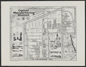
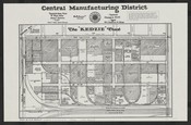
The Central Manufacturing District :the "Crawford" tract.
Local ID(s):
maps-0318
Language(s):
English
Spatial(s):
(:unav)
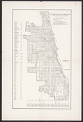
Outline map of Chicago including the cities of Evanston and Berwyn, the town of Cicero, and village of Oak Park.
Local ID(s):
maps-0066
Language(s):
English
Spatial(s):
Illinois -- Chicago Region
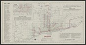
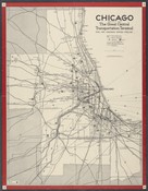
Map of rapid transit lines :(the elevated) /
Local ID(s):
maps-0249
Language(s):
English
Spatial(s):
7013596
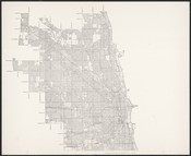
[Map of Chicago] /
Local ID(s):
maps-0063
Language(s):
English
Spatial(s):
7013596
Chicago industrial area, the great central transportation terminal :Rail, air, highway, water, pipeline /
Local ID(s):
maps-0231
Language(s):
English
Spatial(s):
7013596
Metropolitan Chicago.
Local ID(s):
maps-0052
Language(s):
English
Spatial(s):
Illinois -- Chicago Metropolitan Area
Map of Chicago.
Local ID(s):
maps-0065
Language(s):
English
Spatial(s):
7013596
Square mile map of Chicago /
Local ID(s):
maps-0102
Language(s):
English
Spatial(s):
7013596
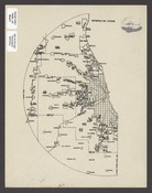
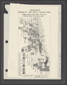
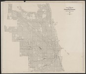
Chicago, nationality and racial groups, 1940 /
Local ID(s):
maps-0093
Language(s):
English
Spatial(s):
7013596
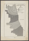
[City of Chicago average precipitation for 1926 to 1940].
Local ID(s):
maps-0089
Language(s):
English
Spatial(s):
7013596
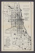
Industrial structures within City of Chicago by square miles /
Local ID(s):
maps-0175
Language(s):
English
Spatial(s):
Illinois -- Chicago Region
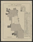
Map of Chicago showing growth of the city by annexations and accretions /
Local ID(s):
maps-0280
Language(s):
English
Spatial(s):
7013596
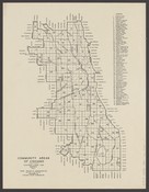
Community areas of Chicago :Chicago land use survey 1940.
Local ID(s):
maps-0119
Language(s):
English
Spatial(s):
7013596
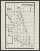
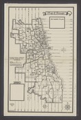
Map of Chicago :50 ward plan.
Local ID(s):
maps-0160
Language(s):
English
Spatial(s):
7013596
The "Kedzie" tract.
Local ID(s):
maps-0319
Language(s):
English
Spatial(s):
7022144
[Map of Chicago] /
Local ID(s):
maps-0064
Language(s):
English
Spatial(s):
7013596
Map of city of Chicago /
Local ID(s):
maps-0062
Language(s):
English
Spatial(s):
7013596
[Map of Chicago draft board areas].
Local ID(s):
maps-0162
Language(s):
English
Spatial(s):
7013596
Search & Browse
Browse Collection by
Subject
Decade
Subject Specialist
Cecilia Smith
Director of Digital Scholarship
ceciliasmith@uchicago.edu
1-773-702-8761