Skip to Main Content
|
|
|
Toggle navigation
Ask a Librarian
View Hours
Support the Library
My Accounts
Search
Catalogs
Library Catalog
UBorrow
BorrowDirect
WorldCat
Other Catalogs
Other Search Tools
Articles Plus
Database Finder
EJournals
Website Search
Borrow
& Request
Borrowing
Borrowing & Renewing
Due Dates & Loan Periods
Fines & Lost Items
Course Reserves
My Accounts
Requesting
Request Articles & Chapters
Request Books & Other Media
Suggest a Purchase
Research
& Teaching
Research Help & Tools
Ask a Librarian
Subject Specialists
Citation Management
Help Guides
Subject Guides
Teaching Support
Course Reserves
Research Instruction for Courses
Scholarly Communication & Publishing
Dissertation Office
Digital Scholarship
Copyright Info
Collections
& Exhibits
Collections
Notable Collections
Digital Collections
Collecting Areas by Subject
Other Local Collections
Exhibits
All Exhibits
Web Exhibits
Research Centers
East Asian Collection
Maps Collection
Southern Asia Collection
Special Collections
Spaces
& Services
Using Our Spaces
Visiting the Library
Library Hours
Book a Room
Places to Study
Copy, Print, Scan
TECHB@R
Libraries
Our Locations
Crerar
D'Angelo Law
Eckhart
Mansueto
Regenstein
Special Collections
SSA
About
About the Library
Mission & Strategic Plan
Facts
Departments & Staff
Employment
Support the Library
Library Surveys & Reports
Library Policies
Conferences
Library Boards & Committees
News & Events
News
Workshops & Events
Libra (newsletter)
Social Media Directory
Collections & Exhibits
>
Collections
>
Mapping Chicagoland
> Results with decades: 1920s
Results with decades: 1920s
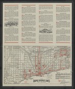
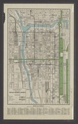
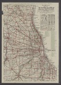
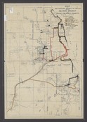
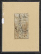
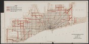
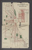
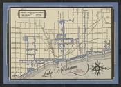
Map of rapid transit lines.
Local ID(s):
maps-0236
Language(s):
English
Spatial(s):
7013596
Guide to Chicago :use the rapid transit lines from where you are to where you want to go /
Local ID(s):
maps-0235
Language(s):
English
Spatial(s):
7013596
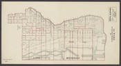
[Ward maps of Chicago].
Local ID(s):
maps-0156
Language(s):
English
Spatial(s):
7013596
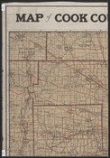
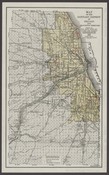
Map of Cook County and vicinity :showing all of Cook County, all of Du Page County, the southern portion of Lake County, the southeastern portion of McHenry County, the eastern half of Kane County, the eastern half of Kendall County, the northern half of Will County, and the western portion of Lake County, Indiana.
Local ID(s):
maps-0036
Language(s):
English
Spatial(s):
7013649 Illinois -- Chicago Region
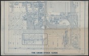
The Union Stock Yards.
Local ID(s):
maps-0363
Language(s):
English
Spatial(s):
7013596
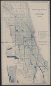
City of Chicago :showing the main portion of the city.
Local ID(s):
maps-0285
Language(s):
English
Spatial(s):
7013596 Wisconsin -- Milwaukee
Lake front development.
Local ID(s):
maps-0296
Language(s):
English
Spatial(s):
1102844
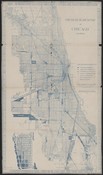
Map of Chicago showing growth of the city by annexations.
Local ID(s):
maps-0276
Language(s):
English
Spatial(s):
7013596
School map of Chicago.
Local ID(s):
maps-0138
Language(s):
English
Spatial(s):
7013596
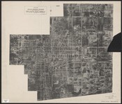
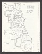
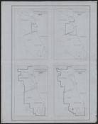
Statistical boundaries of local communities in Chicago, 1920.
Local ID(s):
maps-0110
Language(s):
English
Spatial(s):
7013596
Map of the Sanitary District of Chicago showing dilution system and sewage treatment projects.
Local ID(s):
maps-0185
Language(s):
English
Spatial(s):
Illinois -- Chicago Region Illinois -- Metropolitan Water Reclamation District of Greater Chicago
Clason's double indexed map, Chicago.
Local ID(s):
maps-0283
Language(s):
English
Spatial(s):
7013596
[Plan of projected 1933 World's Fair].
Local ID(s):
maps-0324
Language(s):
English
Spatial(s):
(:unav)
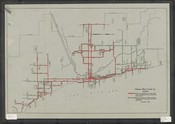
Motor coach lines of Chicago.
Local ID(s):
maps-0204
Language(s):
English
Spatial(s):
7013596
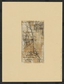
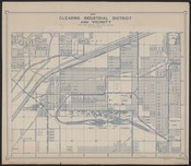
Clearing Industrial District and vicinity.
Local ID(s):
maps-0330
Language(s):
English
Spatial(s):
(:unav)
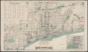
Rapid transit and streetcar lines which serve Chicago.
Local ID(s):
maps-0234
Language(s):
English
Spatial(s):
7013596
Ward map, City of Chicago :50 ward plan.
Local ID(s):
maps-0154
Language(s):
English
Spatial(s):
7013596
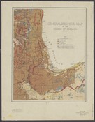
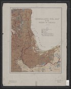
Generalized soil map of the region of Chicago /
Local ID(s):
maps-0171
Language(s):
English
Spatial(s):
Illinois -- Chicago Region
Forest preserves map of Cook County :owned and controlled by the Forest Preserve District of Cook County : embracing automobile roads, forest preserves, golf courses, interurban railways, lakes, and steam roads within fifty miles of Chicago /
Local ID(s):
maps-0168
Language(s):
English
Spatial(s):
Illinois -- Chicago Metropolitan Area
Rice's Pathfinder map of automobile roads--forest preserves--golf courses--interurban railways--lakes and steam roads within fifty miles of Chicago /
Local ID(s):
maps-0193
Language(s):
English
Spatial(s):
Illinois -- Chicago Metropolitan Area
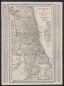
Daprato Chicago map :showing location of Catholic churches /
Local ID(s):
maps-0120
Language(s):
English
Spatial(s):
7013596
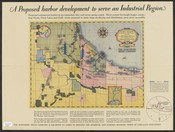
Pictorial map of Chicago's harbor and industrial region, showing location of important industries, plants, and proposed harbors.
Local ID(s):
maps-0254
Language(s):
English
Spatial(s):
7013596 United States -- Calumet Region
Auburn-Gresham /
Local ID(s):
maps-0295
Language(s):
English
Spatial(s):
(:unav)
Rand McNally pocket map of Chicago business district.
Local ID(s):
maps-0072
Language(s):
English
Spatial(s):
7013596
Chicago Motor Coach Co.
Local ID(s):
maps-0203
Language(s):
English
Spatial(s):
7013596
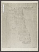
Map of Chicago.
Local ID(s):
maps-0097
Language(s):
English
Spatial(s):
7013596
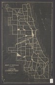
Map of Chicago showing local communities with 1920 population.
Local ID(s):
maps-0109
Language(s):
English
Spatial(s):
7013596
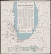
Electrically operated railroads and auxiliary motor coach routes serving the lower Lake Michigan region.
Local ID(s):
maps-0217
Language(s):
English
Spatial(s):
7013596 Illinois -- Chicago Metropolitan Area Indiana Michigan Wisconsin
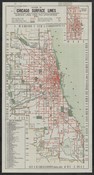
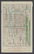
System of Chicago surface lines :showing principal points of interest and direct lines of transportation : surface lines take you everywhere.
Local ID(s):
maps-0237
Language(s):
English
Spatial(s):
7013596
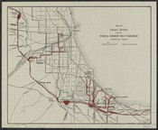
Map of Chicago District showing Indiana Harbor Belt Railroad connecting with all railroads.
Local ID(s):
maps-0215
Language(s):
English
Spatial(s):
Illinois -- Chicago Region
New map, City of Chicago, State of Illinois.
Local ID(s):
maps-0286
Language(s):
English
Spatial(s):
7013596
Rand McNally 1923 detailed auto trails map, Chicago and vicinity, with motor routes to golf links and forest preserves.
Local ID(s):
maps-0194
Language(s):
English
Spatial(s):
Illinois -- Chicago Region
Air map of Chicago Heights, Illinois :showing industrial district, railroads, and land available for industrial development, May 8th 1928.
Local ID(s):
maps-0379
Language(s):
English
Spatial(s):
2027150
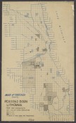
Map of Chicago showing persons born in Lithuania :from 1920 census data.
Local ID(s):
maps-0096
Language(s):
English
Spatial(s):
7013596
Clason's around Chicago motor map.
Local ID(s):
maps-0192
Language(s):
English
Spatial(s):
Illinois -- Chicago Region
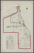
Map of South Park District showing parks and boulevards.
Local ID(s):
maps-0169
Language(s):
English
Spatial(s):
7013596
Cram's Chicago and suburbs :street names, surface, elevated, and steam railways /
Local ID(s):
maps-0034
Language(s):
English
Spatial(s):
Illinois -- Chicago Metropolitan Area Illinois -- Chicago Region
Clason's double indexed map, Chicago.
Local ID(s):
maps-0284
Language(s):
English
Spatial(s):
7013596
Ward map, City of Chicago :50 ward plan passed by the City Council of the City of Chicago, July 22nd, 1921 /
Local ID(s):
maps-0153
Language(s):
English
Spatial(s):
7013596
Cram's city guide map of Chicago.
Local ID(s):
maps-0291
Language(s):
English
Spatial(s):
7013596
Map of the Sanitary District of Chicago showing dilution project and sewage treatment projects.
Local ID(s):
maps-0184
Language(s):
English
Spatial(s):
Illinois -- Chicago Region Illinois -- Metropolitan Water Reclamation District of Greater Chicago
Social-research map of Chicago.
Local ID(s):
maps-0294
Language(s):
English
Spatial(s):
7013596
Region of Chicago /
Local ID(s):
maps-0035
Language(s):
English
Spatial(s):
Illinois -- Chicago Region
McComber's vest pocket street guide :[Chicago, Ill.].
Local ID(s):
maps-0292
Language(s):
English
Spatial(s):
7013596
Map of the Sanitary District of Chicago and surrounding territory showing the Main, North Shore and Calumet-Sag Channels /
Local ID(s):
maps-0182
Language(s):
English
Spatial(s):
Illinois -- Chicago Region Illinois -- Metropolitan Water Reclamation District of Greater Chicago
New street number guide map of Chicago.
Local ID(s):
maps-0293
Language(s):
English
Spatial(s):
7013596
Industrial sites along the main drainage canal of the Sanitary District of Chicago /
Local ID(s):
maps-0174
Language(s):
English
Spatial(s):
7013596 Illinois -- Metropolitan Water Reclamation District of Greater Chicago
Official map of Chicago and suburbs.
Local ID(s):
maps-0037
Language(s):
English
Spatial(s):
Illinois -- Chicago Region
Wagner's complete map of Chicago.
Local ID(s):
maps-0287
Language(s):
English
Spatial(s):
7013596 Illinois -- Chicago Region
General layout plan for lake front extension from Jackson Park to 47th Street.
Local ID(s):
maps-0342
Language(s):
English
Spatial(s):
7022150
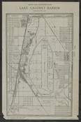
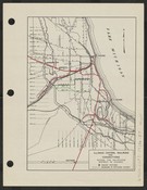
Arend van Vlissingen plan, Lake Calumet Harbor.
Local ID(s):
maps-0253
Language(s):
English
Spatial(s):
1115772 7013596 Illinois -- Chicago -- South Deering
Map of Chicago in 1921.
Local ID(s):
maps-0155
Language(s):
English
Spatial(s):
7013596
Interurban and suburban lines operating from Chicago.
Local ID(s):
maps-0216
Language(s):
English
Spatial(s):
Illinois -- Chicago Region
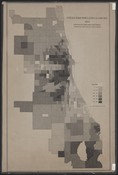
Foreign born population in Chicago, 1920 percentage of foreign born white persons in the total population by census tract.
Local ID(s):
maps-0091
Language(s):
English
Spatial(s):
7013596
Wagner's complete map of Chicago.
Local ID(s):
maps-0290
Language(s):
English
Spatial(s):
7013596 Illinois -- Chicago Region
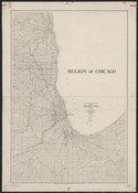
[Boundaries of Chicago].
Local ID(s):
maps-0277
Language(s):
English
Spatial(s):
7013596
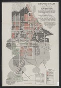
Graphic chart of Chicago's great South Side.
Local ID(s):
maps-0140
Language(s):
English
Spatial(s):
Illinois -- Chicago Region
Municipal railway system, City of Chicago.
Local ID(s):
maps-0233
Language(s):
English
Spatial(s):
7013596
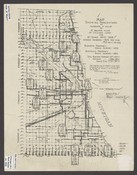
Map showing percentage of increase in value of 21 square miles of Chicago land for 18 years, 1910-1928 /
Local ID(s):
maps-0166
Language(s):
English
Spatial(s):
7013596
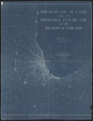
Present use of land and its probable future use in the region of Chicago /
Local ID(s):
maps-0165
Language(s):
English
Spatial(s):
7013596
[The physiography of the region of Chicago].
Local ID(s):
maps-0082
Language(s):
English
Spatial(s):
Illinois -- Chicago Region
Vacation and sight seeing district of Chicago, served by Chicago Surface Lines.
Local ID(s):
maps-0137
Language(s):
English
Spatial(s):
7013596
Rand McNally pocket map of Chicago business district.
Local ID(s):
maps-0071
Language(s):
English
Spatial(s):
7013596
Illinois Central Railroad and connections within the switching district of Chicago.
Local ID(s):
maps-0214
Language(s):
English
Spatial(s):
Illinois -- Chicago Region
Map of the Sanitary District of Chicago and surrounding territory showing the Main, North Shore, and Calumet-Sag Channels, intercepting sewers, pumping stations, and sewage treatment plants /
Local ID(s):
maps-0183
Language(s):
English
Spatial(s):
Illinois -- Chicago Region Illinois -- Metropolitan Water Reclamation District of Greater Chicago
Chicago Motor Coach Company.
Local ID(s):
maps-0205
Language(s):
English
Spatial(s):
7013596
Social-research map of Chicago /
Local ID(s):
maps-0288
Language(s):
English
Spatial(s):
7013596
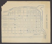
The Loop district.
Local ID(s):
maps-0070
Language(s):
English
Spatial(s):
7013596 7015700
[Chicago Region].
Local ID(s):
maps-0033
Language(s):
English
Spatial(s):
7013596 Illinois -- Chicago Region
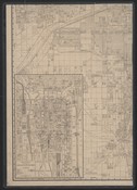
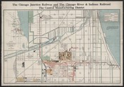
The Central Manufacturing District showing rail & water connections and the Chicago Junction Railway and the Chicago River & Indiana Railroad.
Local ID(s):
maps-0301
Language(s):
English
Spatial(s):
7022144 7022147 Illinois -- Chicago -- McKinley Park
Detailed 1924 auto trails map, Chicago and vicinity /
Local ID(s):
maps-0195
Language(s):
English
Spatial(s):
7007251 Illinois -- Chicago Region
Map of the City of Chicago and Sanitary District showing contours, pumping stations, tunnels, cribs, and parks.
Local ID(s):
maps-0181
Language(s):
English
Spatial(s):
Illinois -- Chicago Region Illinois -- Metropolitan Water Reclamation District of Greater Chicago
Search & Browse
Browse Collection by
Subject
Decade
Subject Specialist
Cecilia Smith
Director of Digital Scholarship
ceciliasmith@uchicago.edu
1-773-702-8761